Hiking Veach Gap in GWNF

Located between Shenandoah Valley and Fort Valley along the North end of the Massanutten Ridge is one of my favorite low-effort high-reward places to hike and backpack.
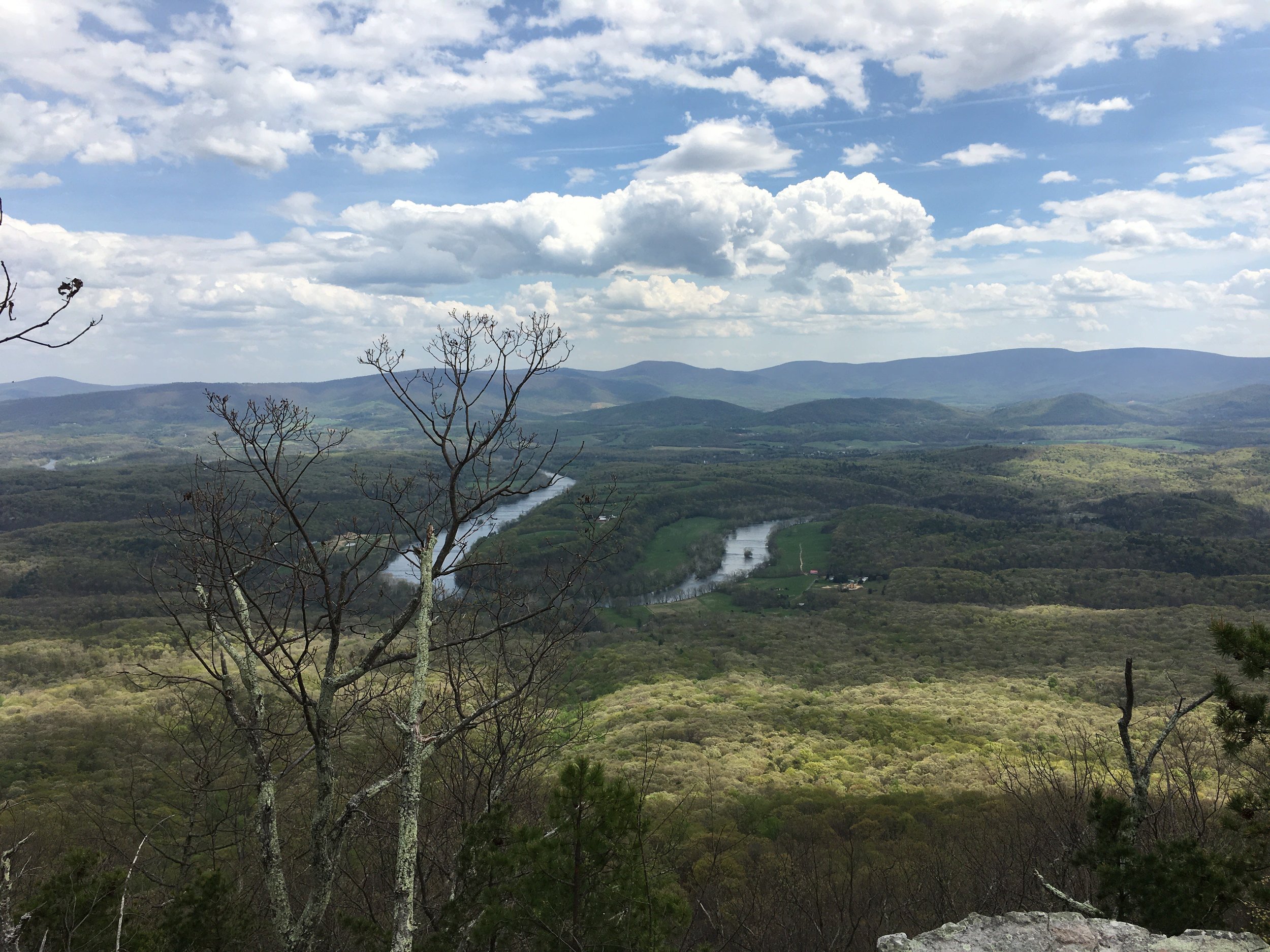
Starting in Fort Valley, this hike will take you through a beautiful forest with old growth pines and up atop the rocky Massanutten ridge to a campsite with sweeping views of the Shenandoah Valley.
My first time doing this hike started with a mid-week desire to step away from busy work schedule to spend the weekend in the mountains. With little time to plan during the week the trip had to be easy to prepare for, be a reasonable drive away, and must have beautiful views. Veach Gap in the George Washington National Forest (GWNF) delivered in every way. I've been coming back to Veach Gap quite often since I first discovered it and have been doing both as an easy backpacking trip and as a day hike.
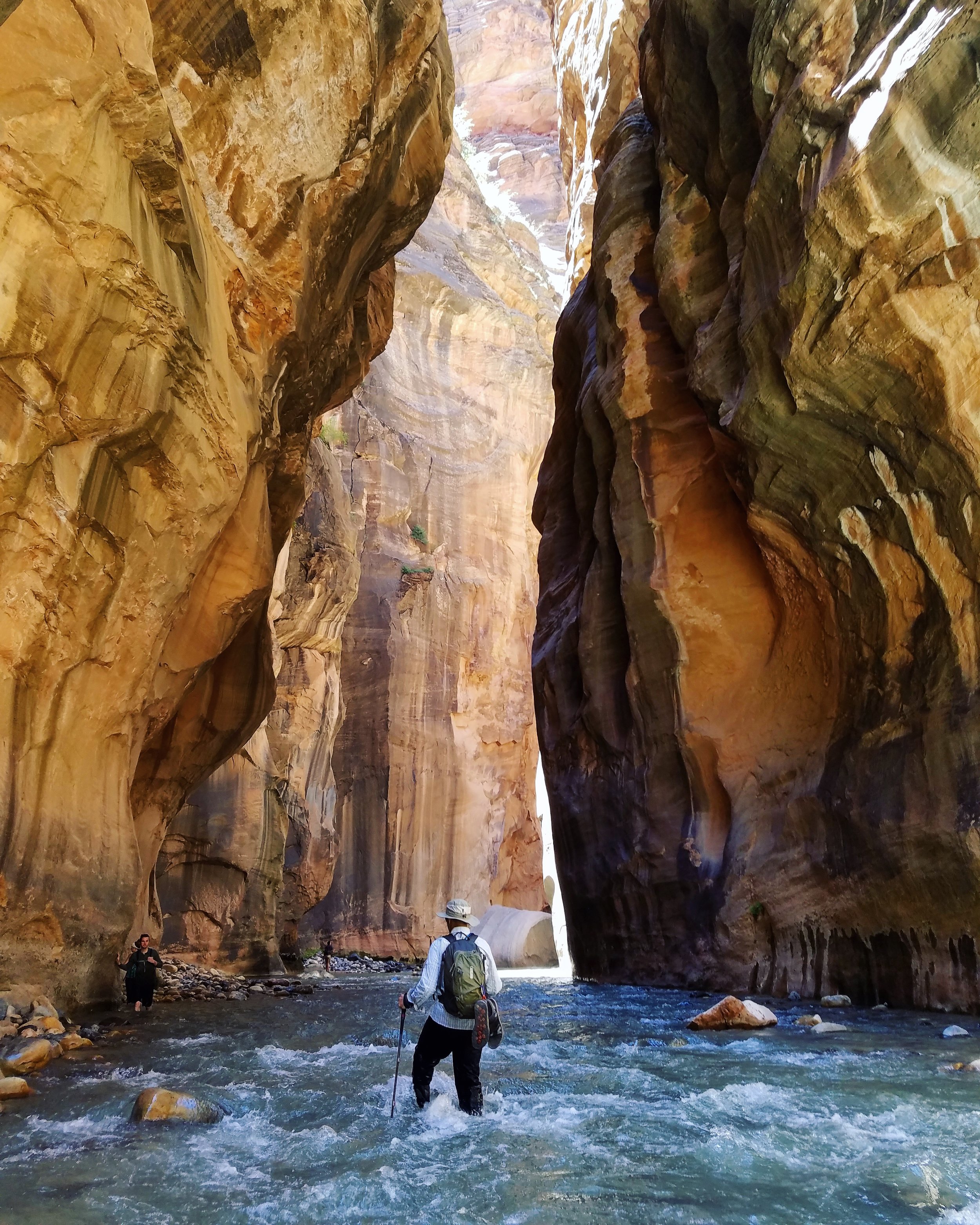
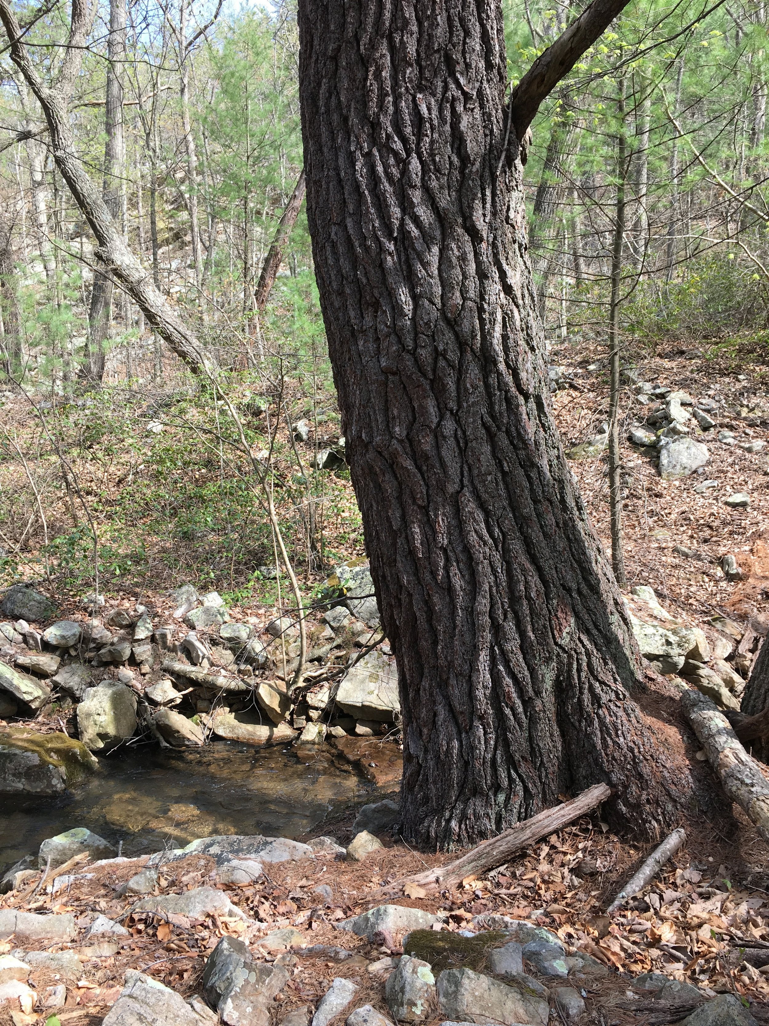
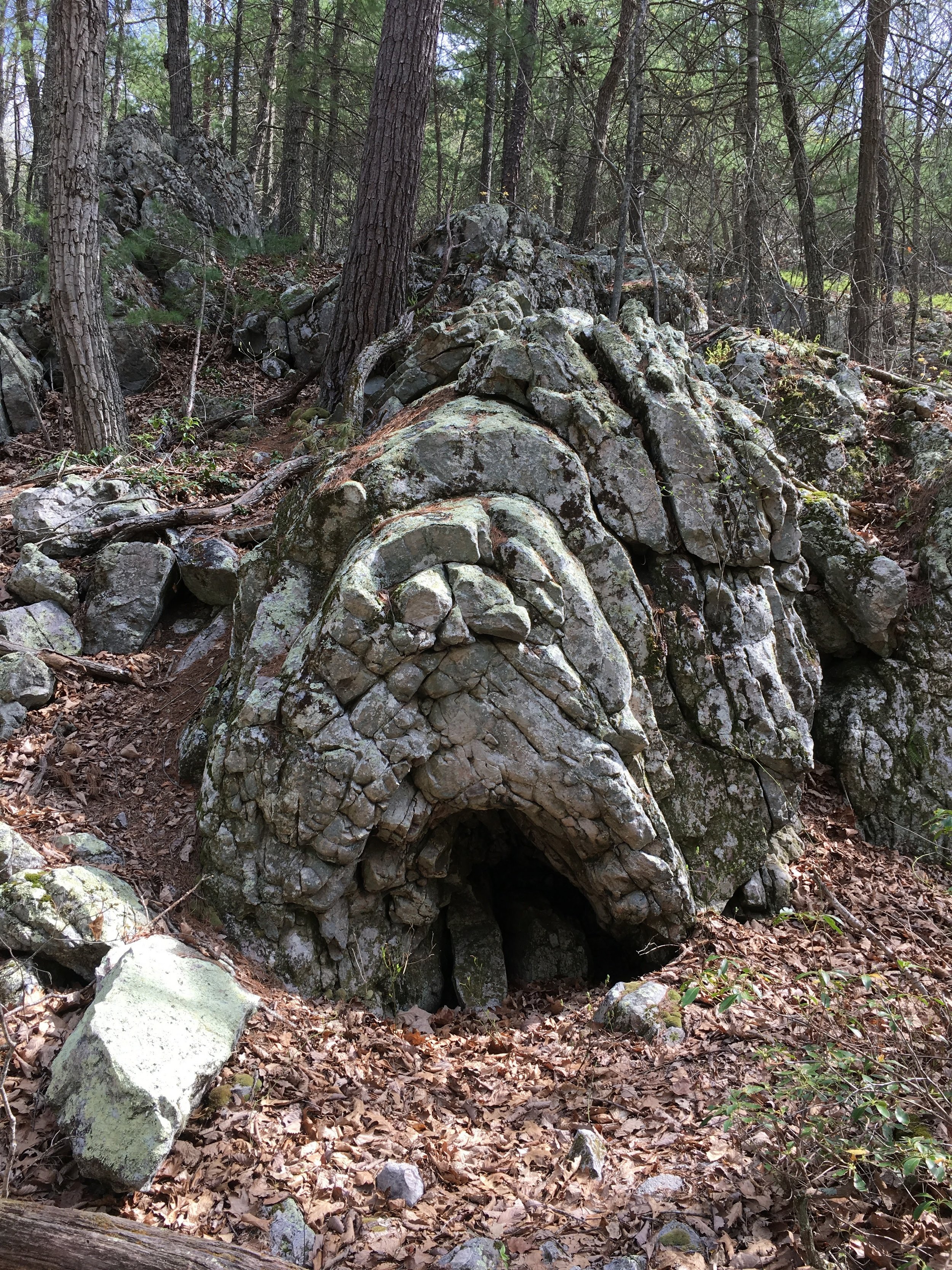
This particular hike is an out-and-back hike of approximately 7 miles and 1,100 feet of elevation gain. The trailhead is at a small gravel parking lot on Veach Gap Road, just off of Fort Valley Road. The yellow blazed Veach Gap trail begins on a fire road and slowly inclines as you join up alongside Mill Run (stream). As you approach the actual "gap" created by the stream splitting Little Crease Mountain you will begin to see some of the area's unique rock formations called anticlines. Evidence of the geological forces that created the Massanutten Mountain, you can clearly see layers of rock that began to fold and buckle. Hiking this trail in the summer months might make it harder to find but there are lots of really good examples visible from the trail.
Passing through Veach Gap you will come to an intersection with the orange and blue blazed Masanutten-Tuscarora Trail. At this section both the blue blazed Tuscarora Trail and the orange blazed Massanutten Trail overlap. From the intersection heading to the right (South) will take you toward the Little Crease Shelter and up to the top of the Massanutten ridge (blazed yellow, orange, and blue). For this trip you will bear left (North) at the intersection and continue on the blue-orange blazed trail.
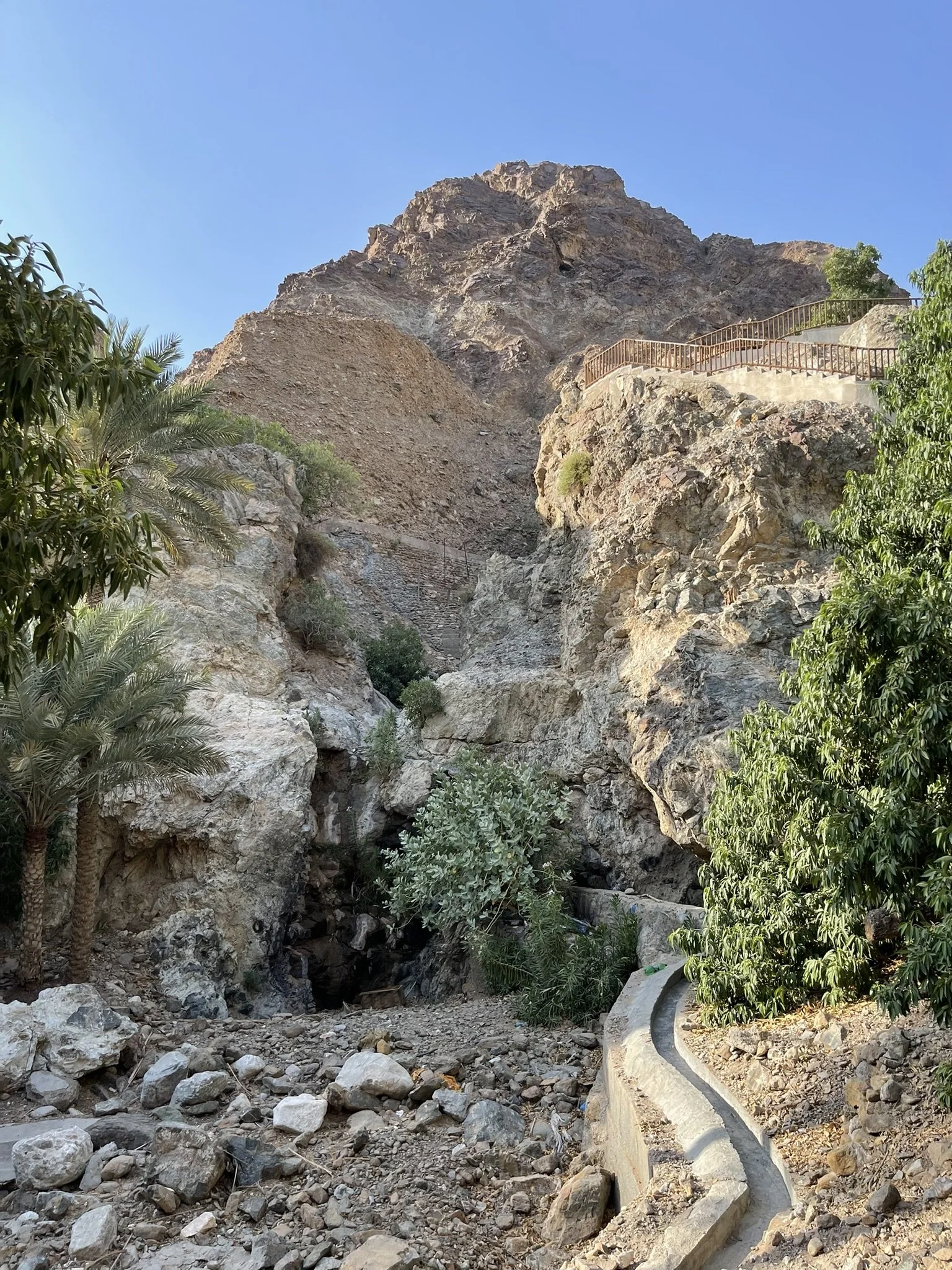
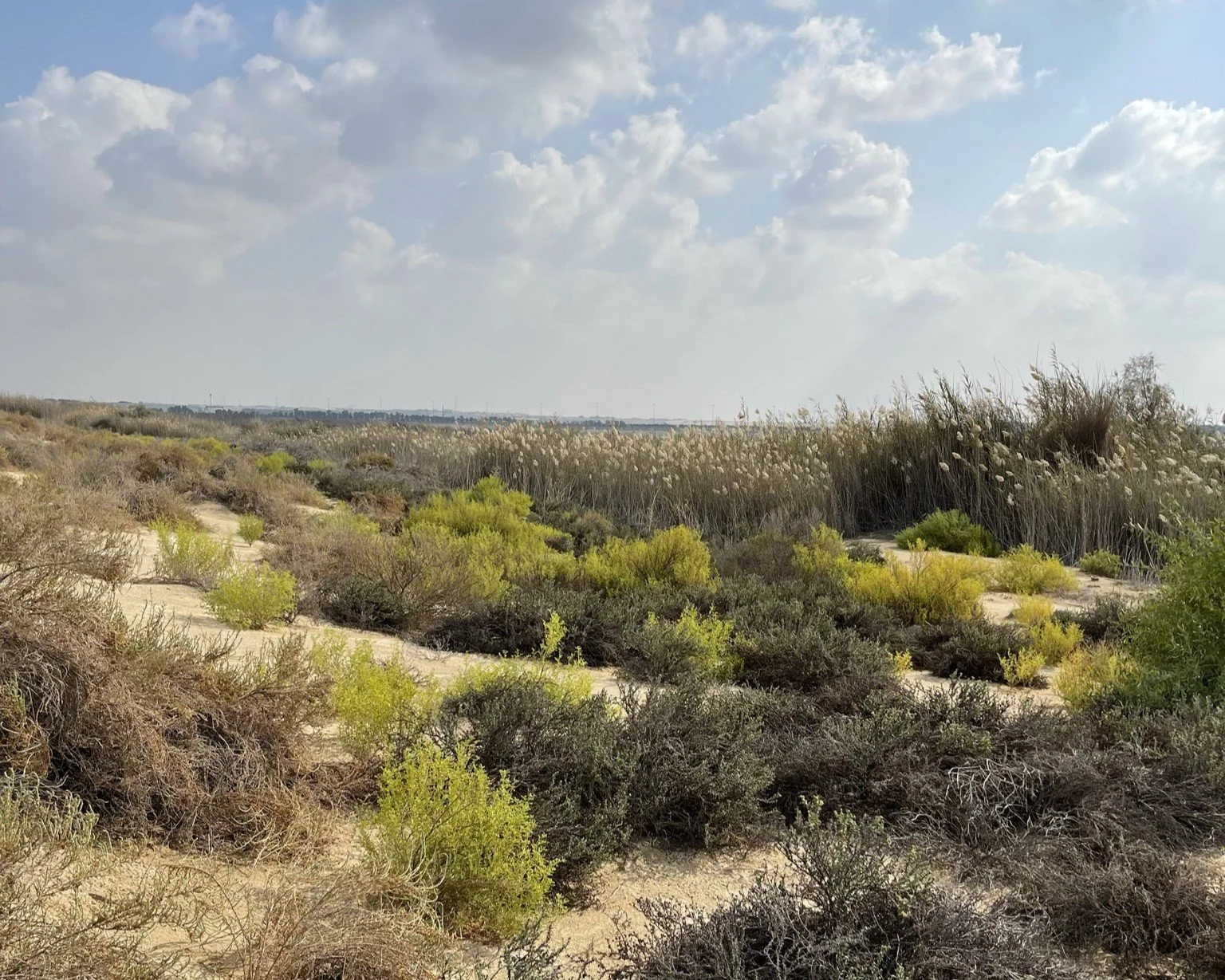
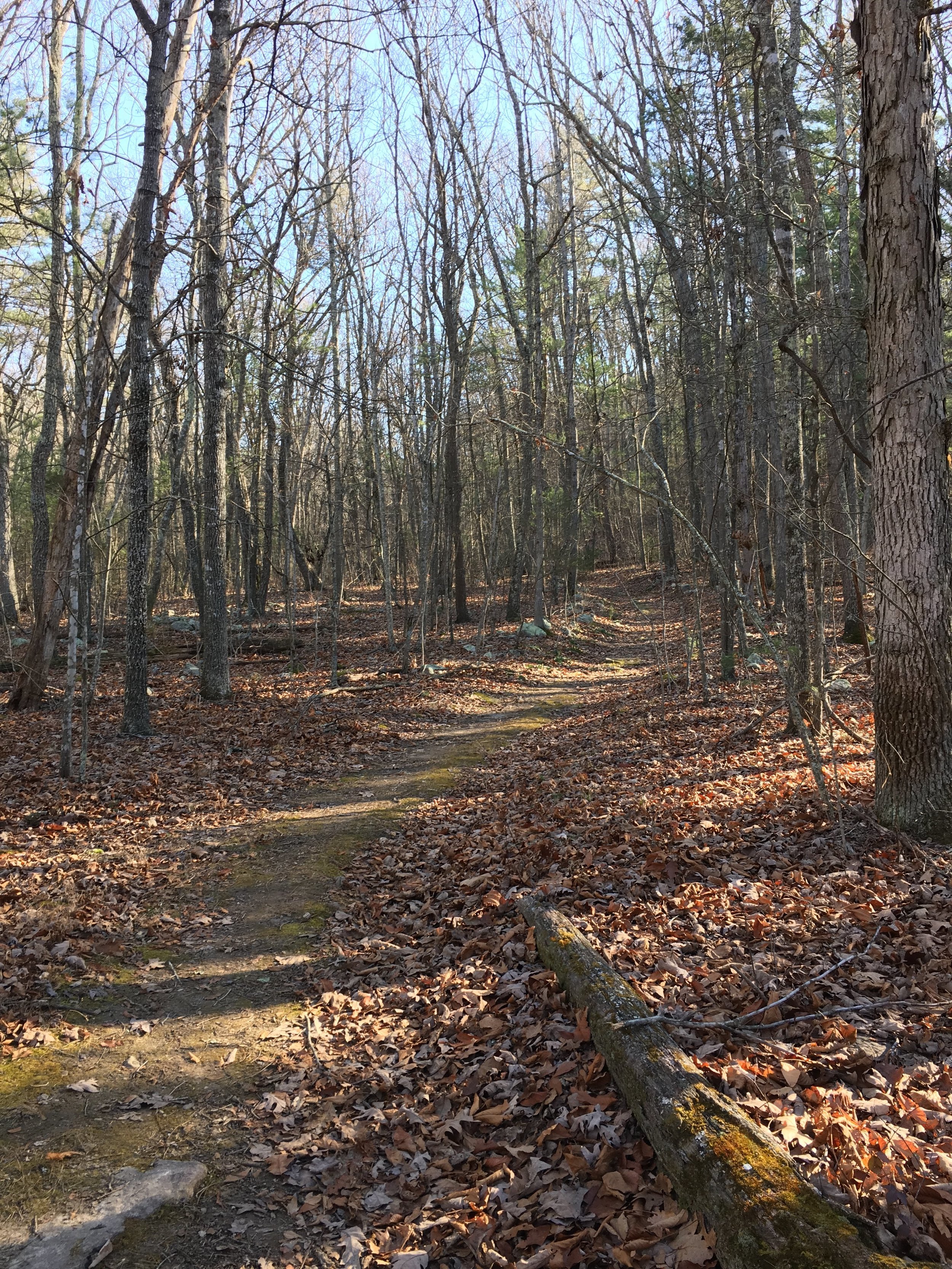
You will pass through a pine grove, which not only adds a refreshing piney smell to your hike but the soft pine needles give your feet a brief respite from the rocky path. As you hike you in the valley between the Little Crease and Massanutten mountains you will notice the ridges slowly converging. As you approach the convergence you will also notice the spring that feeds Mill Run. The trail will begin to incline here as you slowly turn and climb up to the Massanutten ridge. You'll notice a recently burned portion of the mountain and the trail getting increasingly rockier.


As you approach the ridge you will begin to see views of the beautiful Shenandoah Valley including the Sycamore lined South Fork of the Shenandoah River and the mountains of Shenandoah National Park. Continue down the trail a little further to arrive at a wonderful campsite atop the ridge with a fire pit and even some log chairs. If this spot is taken, continue down a little further for another campsite and more views.


You'll notice the lack of tree cover atop the ridge or trees that are great for hanging your bag. Although I've spent nights on the ridge in rain, sleet, and snow I would avoid the ridge during thunderstorms or high-wind events. If sever weather does emerge you can make your way back down the ridge to an open campsite near the convergence of the two ridges or head toward Little Crease Shelter.
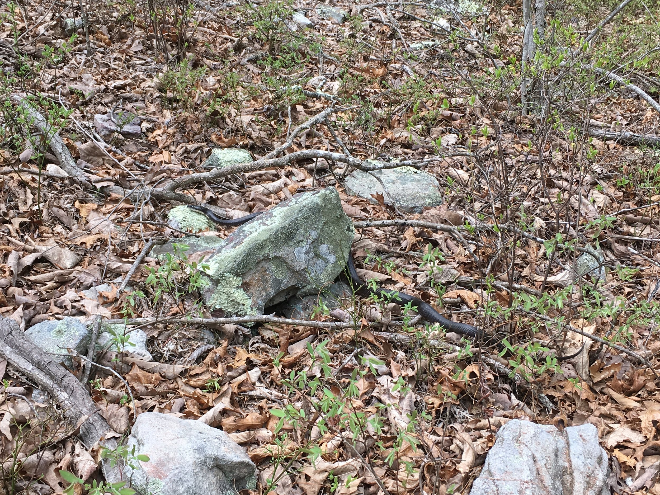
If you're hiking this trail, please be advised of hunting seasons and wear blaze orange. I have encountered active hunters on the trail.
eBird Observation Chart
Hiking
7 mile out-and-back hike with approx. 1100 ft. of elevation gain
This hike takes place in the George Washington National Forest (GWNF) and includes parts of the Massanutten and Tuscarora Trail
The Veach Gap Trail (yellow blaze) from the parking lot to the intersection with the Massanutten-Tuscarora Trail is ~1.1 miles one way
This hike continues Left (North) onto the Tuscarora-Massanutten Trail (blue and orange blaze) approx. 3.5 miles to the campsite
Precautions: ticks, poison-ivy, bears, timber rattlesnakes, hunting
Map
Photos


I am an avid hiker and amateur naturalist. I hike to satisfy that persistent curiosity of what of nature’s wonders lies just beyond the next bend.